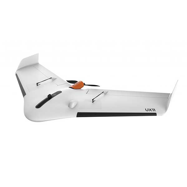
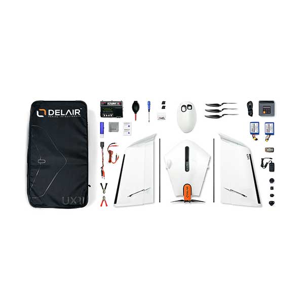
Description
The Smartest Mapping Drone
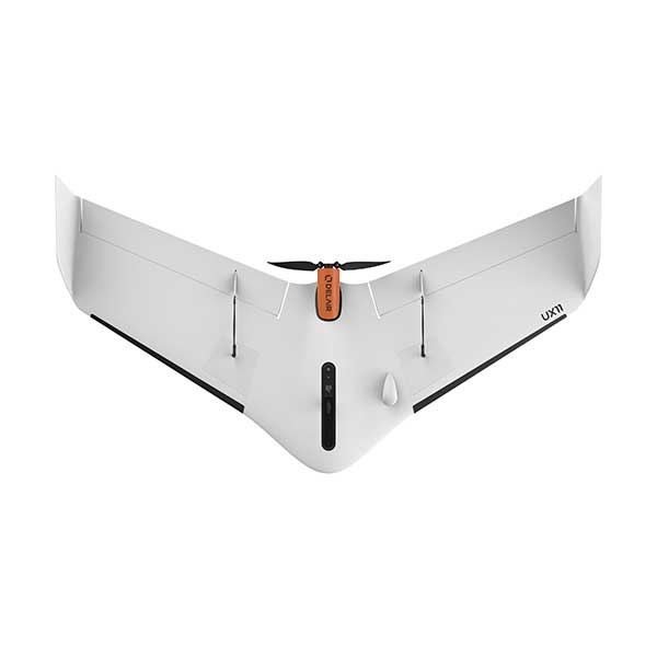
The Delair UX11 is a fixed-wing professional mapping drone offering significant productivity gains, unprecedented ease of use and high quality aerial data acquisition.
Features
- Up to 59 minutes endurance.
- Best in class GSD – 2.1km2 mapped with 1.7cm @ 120m.
- Real time camera to GSC link for in flight quality control.
- Fully integrated industrial 21.4MP camera.
- 3G/4G connectivity for BVLOS.
- PPK as you go.
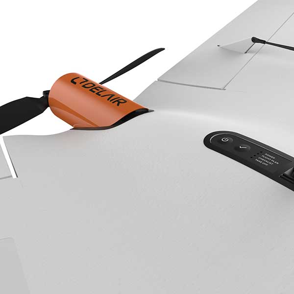
- Hand launch.
- Confident, soft, deep stall landing.
- Android based platform.
Overview
When you think flights and missions, you should immediately think Delair. The fixed-wing Delair UX11 leads the way in large-area mapping with centimetre level precision. The Delair Flight Deck Software allows for intuitive mission planning and monitoring, the unique in-flight photo viewer provides real-time QC, allowing you to be confident in your data. With bird-like take-off and landing, you can launch the UX11 by hand, for landing the UX11 will approach at a steeper angle than most fixed wings and perform a deep stall to land accurately and softly.
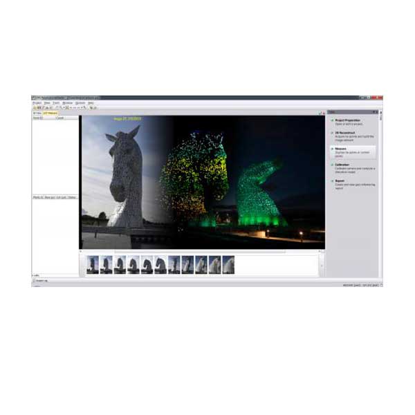
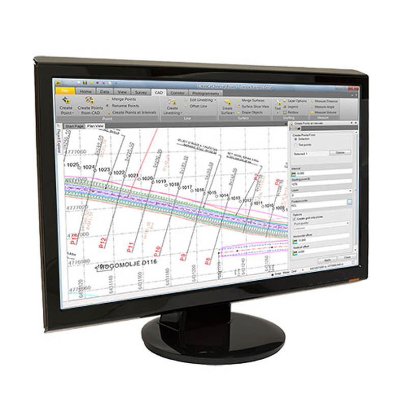
Delair After Flight software allows you quickly assess your coverage and photo overlap and process you PPK data, preparing your data for Orthomosaic in Inpho UAS Master.
Long flight autonomy to map large areas
The UX11 is very productive thanks to its 59 min flight endurance combined with long flying range (53 km/33 mi). No need to sacrifice resolution for productivity when you can have both. In one single flight, you can map 300 ac / 120 ha at 400 ft / 120 m and get a 1.7 cm GSD.
Dual communication systems to fly farther
You can fly our professional mapping drone anywhere: the Delair UX11 is always connected through both a cellular connectivity (3G/4G) and a radio link with the Delair Link ground station (2.4 GHz). It’s also one of only a few BVLOS-ready UAVs. Delair Link offers up to 4 mi / 6.4 km range in FCC regions and 2 mi / 3.2 km in CE regions.
Best-in-class and fully integrated camera
The Delair UX11 onboards a global shutter, fully-integrated industrial-grade RGB camera designed by Delair offering 1 cm GSD imagery.
Live In-flight image quality control
You can control camera settings and quality during flight thanks to a real-time camera to Ground Control Station radio link. In-flight and in the field quality reporting mean no more guessing if your data is photogrammetry-worthy.
Post-Processed Kinematic (PPK) for centimetre accuracy with minimal use of GCP
Our professional mapping drone gives you the precision you need. The Delair UX11 is equipped with a dual-frequency GNSS sensor (L1, L2) and uses both the GPS and GLONASS satellite constellations. You can activate the PPK flexibly as you go: unlimited or on-demand and even retroactively. Delair After Flight software (included) takes care of the PPK processing.