Description
Office Software for Surveyors
Trimble Business Center’s field-to-finish survey CAD software helps surveyors deliver high-accuracy GNSS data, create CAD deliverables, and leverage full data traceability throughout a project’s lifecycle.
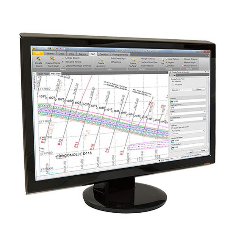
Survey CAD Software
The Trimble Business Center (TBC) survey CAD software offers customizable templates, simplified selection tools, and automated plotting functionality. Surveyors like TBC’s optimized workflows for road and corridor projects, and tools like automated cross section plotting.
Network Adjustment
TBC has a range of tools for processing control, running traverse adjustments, and combining all of your data sources including GNSS, level and total station measurements. TBC uses robust calculations including least squares adjustments within the processing engine so your network is as accurate as it can be.
Surface Modelling
Design, create, process and deliver surface models with Trimble Business Center. We understand how surveyors want to work with 3D surfaces and have specific tools for you to easily integrate them in your work.
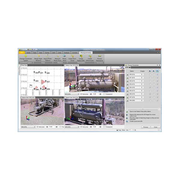
Point Cloud Tools
Many surveyors are working with point clouds as much as they are traditional 2D and 3D datasets. TBC combines point cloud analysis, cleaning, editing, and processing within the same project as your control and other project data.
Surveyors don’t need to switch between multiple software packages to work with point cloud data, you just need TBC.
Data Traceability
Always know where your data came from, and who created it. TBC allows you to have full data traceability back to the raw survey measurements throughout your survey workflows. This means if you have to make a correction, like adjusting a rod height, you can identify this easily and your data value updates immediately throughout any processing and adjustments you’ve made. Full traceability, instant results.
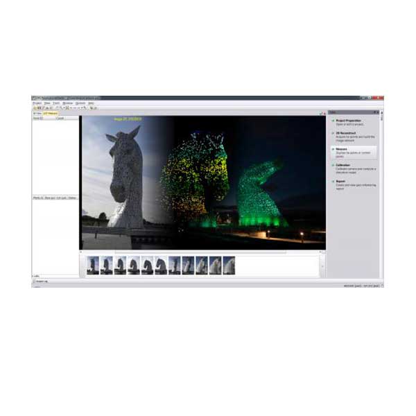
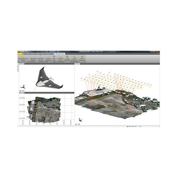
Photogrammetry and UAS
Based on state-of-the-art technology from Inpho, the photogrammetry module allows users to integrate photogrammetry with data collected from GNSS receivers, total stations, and digital levels, surveyors can combine aerial images with GNSS measurements on ground control points and 3D laser scans of buildings to efficiently map large and complex sites.
Geospatial professionals can produce deliverables, including orthophotos, 3D point clouds and digital surface models directly from TBC.
ESRI Integration
If you work with Esri products such as ArcMap and ArcGIS Online, TBC has some valuable tools to help you synchronize your survey data with your GIS data. Now you can link into your Esri geodatabase, and import in Feature Codes and schema, so that your field data is properly formatted and labeled.
AutoCAD & Bentley
If you use AutoCAD or Bentley in your organization, TBC has worked with both of those software product teams to provide integrate and efficient interoperability so you can spend less time with headaches, and more time delivering work to your clients.