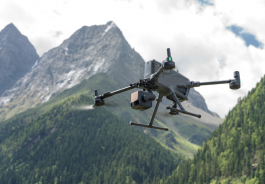
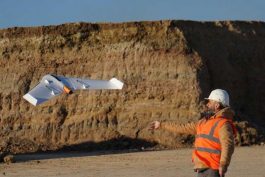
Unmanned Aerial Vehicles (UAVs) are revolutionising the way land surveyors and construction professionals use aerial technology. Now you can undertake a variety of applications including preliminary surveys for corridors and rights-of-way, volumetric surveys, high level topographic surveys, land fill inspection and much more, with huge time and money savings over traditional methods. Whether it’s a multi-sensor rotary aircraft to fly in and out of tight places or a longer-range fixed-winged craft with a precisely calibrated camera and precision GNSS receiver, UAVs let Geomatic professionals acquire, process and deliver land surveying data in a timely, accurate and safe way.
“T10 Battery Pack – Enhanced Capacity” has been added to your basket. Continue shopping